The Way West
Travels by Arrow - June 2007 - Leadville, CO & Grand Canyon, AZ
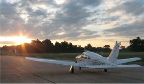
This trip really started 40 years ago. The summer of my 16th birthday, I traveled the West with my parents. We saw the corn fields of Iowa, Nebraska, and Kansas on our way out, the Rockies loom on the horizon for miles, the canyons, cliffs and arches of the Grand Escalante. And then we reached the Grand Canyon. It was there that I first rode in a non-jet aircraft. I think it was a Cherokee Six. In the back row, because I was smaller, I saw the canyon from below the rim. It was only $10 but it started me on my aviation adventure. I still have the map advertising the route and it's framed and hanging in our living room.
 The Leadville, Colorado side trip is just a manifestation of my love of the mountains. It doesn't hurt any that it's the highest paved strip in North America at 9927 feet MSL. And I had the plane to do the job, a Turbo Arrow. Describing the route out and back might also give some insight into one set of challenges that face a pilot on a really long cross country. It started real early, in fact, before the tower got in operation at CGF. Unusual it was to use the Control Tower frequency as a Unicom.
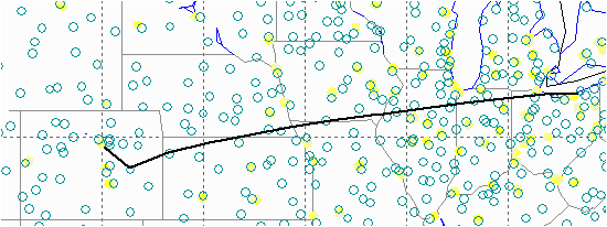
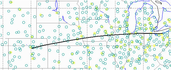 The first interesting item is the course line. Notice that it curves to match a Great Circle route for the shortest distance, some 1100 nautical miles. I started out of Cleveland heading due west along the lakeshore. First stop was Burlington, IA (KBRL). With VFR for the first leg and some impending weather in Kansas, the decision for stop 2 would be made here. I had planned on a spread of possible stops across the direction of flight from McCook (KMCK) to Goodland (KGLD) to Garden City (KGCK). Looking at the path and speed of the storm cell I decided to go around the north side and head for KGLD. McCook was expecting some major storms in the afternoon.
 With a route this long, you're bound to cross a few frontal systems. Sure enough, just north of Topeka, KS there was a storm system moving north and topping out above 20k, my limit. Fortunately, it only took a small reroute north of it while using IFR services but staying out of the clouds, I thought. As I kept watching and got closer, I kept stepping up a couple thousand finally topping out at 16k. Now you'd think that in June you could just fly through the edges of some light clouds. Well not this time, a few seconds in these clouds and I had some clear ice on the wings. It took a most helpful controller to let me descend to 12k before I got back above 0C and melted it off. After the fun, it was just some normal cloud flying {1.4Mb avi file}. On a Cherokee, the temperature probe in the windscreen is one of the best indicators of whether you are picking up ice. Its small sharp cross section is very efficient at ice accretion. But there's another. The overhead vent. I noticed that the airflow almost stopped until I thawed out. The intake is through a screened hole about halfway up the tail. So just when things get tough it's easy to loose your cool without that airflow in your face!
Now clear this storm system it was on to Kansas. About 20 miles out I cancelled IFR and went on GPS to find the airport. I had a couple of grain silos, town, and road curves spotted on the map. Ceilings were about 4,000 AGL and it seemed like you could see a long ways over the flat lands of Kansas in the hazy sunshine... but no Goodland. With all the plowed farmland shapes, it was hard to pick out the airport in the low contrast view over the cowling. Hey, 4 miles out is good enough! And I thought it was tough to find airports back east with trees around them. Just remember it's not over until the number of takeoffs equals the number of landings. The wind was howling from the south at 17G27, fortunately almost right down the runway. Why worry, a Waco biplane landed in this weather right behind me on their way to Topeka.
 The high cloud bases that were dumping water on us were a sight to see. Small heavy shower cells were blowing north across and around the field. But visibility was great around them. Checking the weather, there was an even worse big yellow blob between me and Denver. One thing about pilots is the comradarie. There was another fellow who was trying to get to Glenwood Springs. He flies this route often and offered to share his experience with the use of my stormscope. So, I took off behind him in the edge of one of the showers and headed southwest for the Hugo VOR to skirt the storm and then turn back nortwest to Denver. Walls of water could be seen more clearly coming out of the clouds around the airport.
We were flying around the southern breeding ground for this storm. A nice dashed brown line on a weather map otherwise known as a trough. Clear to the south but to the north clouds were being pulled out of the moist air like cotton candy and forming the nasty stuff that you don't dare fly through. Almost to Hugo, we turned northwest, communicating on 122.75. He let me know that it would be a good idea to pick up a couple thousand in altitude since there was some higher terrain just before Denver. Sure enough a small ridge line cut into the AGL. Pulling out the Denver area chart I made sure I could stay away from the Denver Class B on the way into Centennial (KAPA). Getting the ATIS, this time the wind was howling from the north at 15G25kts. I guess that's why they call it a trough... the winds had done a 180 degree twist over a 100nm route. Of course, on the way into runway 01, the tower asked if I could take the crosswind for 28 because they were so busy. Sure, "I'll try it" I said, not exactly your standard reply to the tower. As with a lot of times I've had crosswinds, there's a lot of variation in the wind speed and at some point you find the lull and get the bird on the ground.
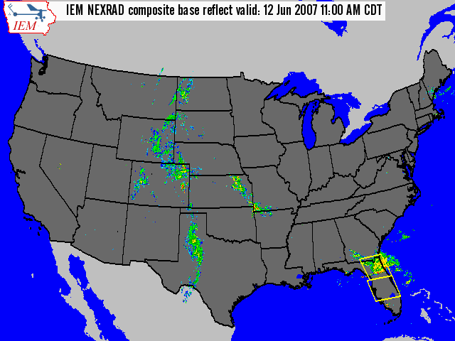
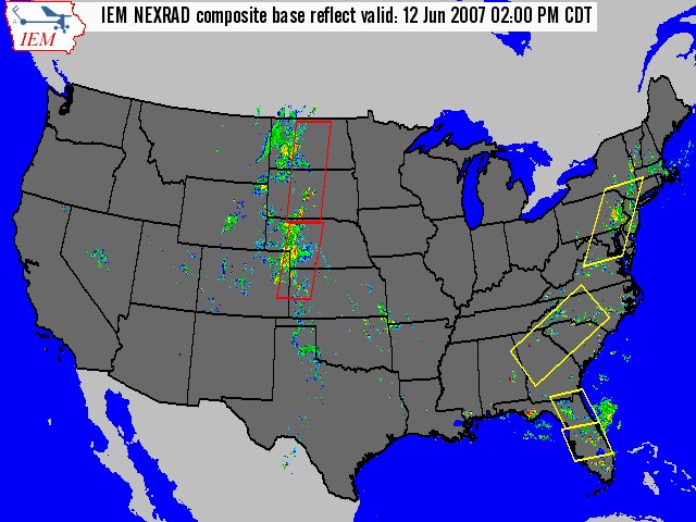
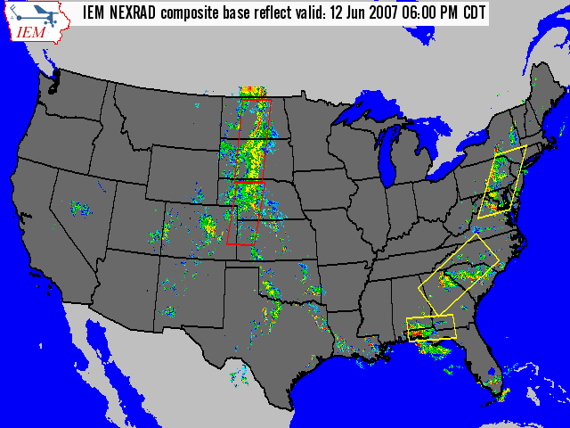 After all the flying around storms to keep dry, I get stranded outside my hotel by a downpour from the storm I was just watching develop down by the Hugo VOR. That's just southwest of the red thunderstorm warning box on the radar image. Lucky we left when we did. You can see from the radar picture that Denver got itself a nice thunderstorm. With the weather and fuel stops the route didn't look much like a Great Circle anymore, particularly with the detour at the end of the flight into Denver:
The Final Route: KCGF -> KBRL -> KGLD -> HGO -> KAPA
Back to the Home page